Plan Demre around the Church of St Nicholas, the Myra rock tombs, Andriake and Kekova, with the relics question answered honestly.
Walk this route
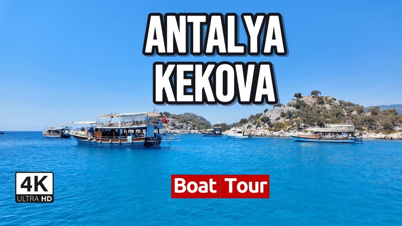
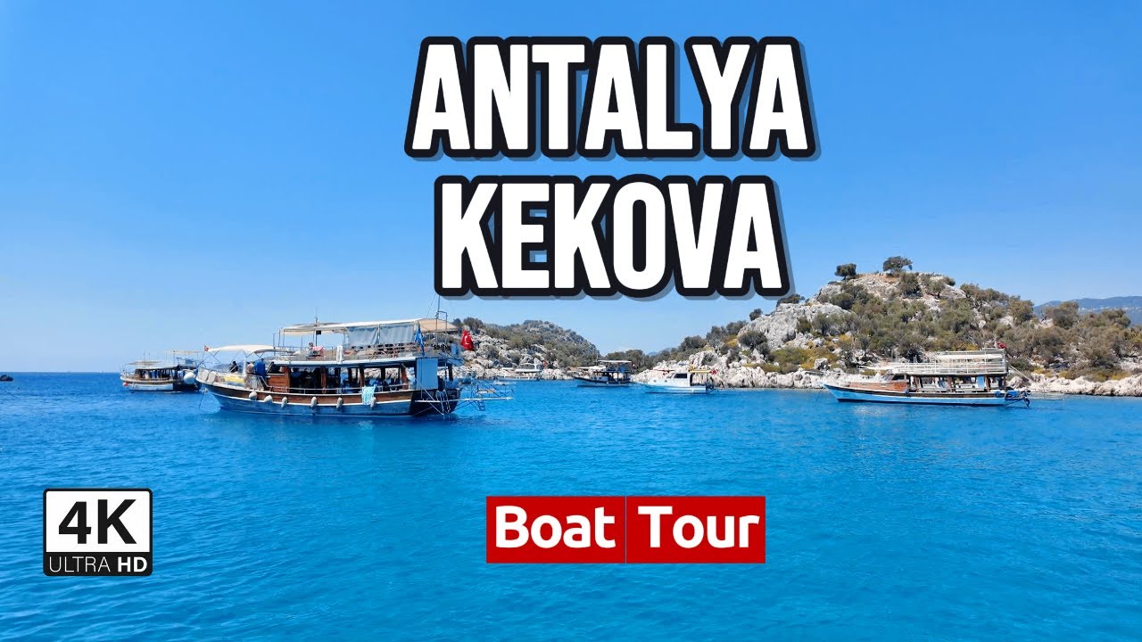
Exploring Antalya's Sunken City and Swimming with Turtles | Kekova Boat Tour 4K
Watch the 4K walkPlaces on the map
15 pinsNumbers match the order in the article. Tap a pin for directions.
--- title: "Demre, Myra and Kekova travel guide: Santa Claus's church, the rock tombs and the sunken city" description: "An honest guide to Demre: why St Nicholas's bones are in Bari and not in his church, how solid the Patara birth story actually is, the 1.5 km between the rock tombs and the basilica, what the Kekova swimming ban really covers, and what a boat trip is genuinely like. How many days, when to go, what to eat." city: "Demre" lang: "en" ---
Demre: the saint's town, under plastic
Most people who come to this church are here to see something that is not here. Inside the Church of St Nicholas at Demre there is a broken sarcophagus. People photograph it, guides point at it, and it is the emotional centre of the visit. The saint's bones are not in it. In the spring of 1087, sailors from the Italian city of Bari took the main bones of the skeleton out of that grave, over the objections of the Greek Orthodox monks who looked after it. The remains reached Bari on 9 May 1087. Two years later Pope Urban II personally laid them in the tomb beneath the altar of the new Basilica di San Nicola, where they still are. The smaller fragments the Bari men left behind were collected by a Venetian fleet in 1100 and taken to San Nicolò al Lido.
There is no reason to soften this, because the site does not soften it either. Excavations that began in 1988 under S. Yıldız Ötüken of Hacettepe University uncovered a sarcophagus described as desecrated, and it is thought to be the original burial place. Thought to be. Not proven. So the first thing to understand about Demre is that it is not a saint's tomb. It is the place a saint's tomb was emptied. That is a stranger and better story than the one on the brochure.
Beyond the church, the district is three separate things that visitors routinely merge into one. The basilica sits inside the modern town. Myra's rock tombs are about 1.5 km north of it, a separate site with a separate entrance. Kekova is neither a town nor a ruin: it is a protected region of roughly 260 square kilometres spread along the coast to the west, containing an uninhabited island, two villages and four ancient cities. You can compress all three into one day. If you do, none of them will land.
Who is this for? Anyone who likes archaeology they can walk around in, anyone happy to spend a day looking at things from a boat, anyone tired of the hotel strip further east. Who is it not for? People who want shade and a beach. Myra has no shade. Kekova mostly does not let you off the boat. In July at midday this coast is not a pleasure, it is an endurance exercise.
Quick answer
Demre works as one morning for the church and Myra, a separate full day for Kekova, done with a car, in April, May or October.
- Church and Myra: half a day. Two sites, two entrances, 1.5 km apart.
- Kekova: one full day. Boats leave from Çayağzı or Üçağız, and also from Kaş.
- Andriake: the Museum of Lycian Civilizations is inside Hadrian's granary. Half a day.
- Swimming is banned over the sunken city. Not across the rest of Kekova. The distinction matters and is explained below.
- The church has a modern roof over it. Adjust any open-air ruin expectations now.
- A car: effectively required. Buses reach the town centre and not much else.
- Beds: limited in Demre. Most visitors sleep in Kaş and come across.
1. Church of St Nicholas (Noel Baba Kilisesi)
Nicholas was bishop of Myra in the 4th century, and almost everything told about him was written down centuries after he died. One of the few early anchors is a list of attendees at the Council of Nicaea compiled by Theodore Lector around 510 to 515, where he appears as "Nicholas of Myra of Lycia". So the bishopric is historically reasonable. The rest, including the bags of gold thrown through a window to dower three daughters, is hagiography. That story is the seed of the gift-giving Santa Claus, and it grew in Europe long after Nicholas was gone.
The building is a Byzantine basilica and the sources do not agree on when it was founded. One line credits Theodosius II, who ruled 401 to 450. Another puts construction at 520 under Justinian. Both agree it stands over an older church where Nicholas served. Silt buried it over the centuries. In 1862 Tsar Nicholas I of Russia paid for a restoration and added a tower. When Demre's Greeks left in the 1923 population exchange, the church emptied.
A protective roof covers it now. That roof is why the frescoes survive, and it also makes the interior dim and tight when tour groups arrive. It is on UNESCO's tentative list, not the World Heritage List itself. Verify opening hours officially.
2. Myra: the rock tombs and the theatre
From a distance the rock tombs look like apartment facades pressed into the cliff, and the resemblance is not accidental. The Lycians carved their tombs as translations of timber houses into stone: projecting beam ends, door frames, even roof joists, all imitated in rock. They put their dead in something shaped like the house they had lived in.
Directly below sits the Roman theatre. The seating survives largely intact, and blocks fallen from the stage building have been left piled where they landed in the orchestra. That pile is the best thing on the site. Nobody has tidied it, so you are looking at what the earthquake actually did rather than at what a restoration team decided it should look like.
There is no shade anywhere. This is not a midday site. Go early or late. Excavation continues here and sections can be closed at short notice, so verify current access officially. It is a separate site from the church and not a walk.
3. Demre town and the greenhouse plain
Look down on Demre from any height and you see a district covered not in tourism but in plastic. Myra's ancient floodplain is now greenhouses, end to end. Tomatoes, peppers, citrus. The road down to the sea runs for kilometres between polythene tunnels, and this, not the church, is the actual economy.
Knowing that makes the town legible. Demre was not built for visitors. Coaches arrive, unload at the basilica, reload and leave, and the town carries on with its own business. The centre is small: a few streets around the municipal building, tea houses, shops selling irrigation fittings and seed. The church sits right inside it, which means a visitor can see the basilica and never register that they were in a working farm town.
Half an hour on foot covers it. It is also the sensible lunch stop, because options on the Kekova shore are thin and priced for the view. The coordinate marks the area around the municipality, not a doorway.
4. Andriake, the harbour of Myra
Myra was not a port. This was its port. Andriake sits at the mouth of the river on the western edge of the plain, about 20 stadia downstream from the city. It is well attested in ancient writing: Ptolemy lists it, Pliny calls it Andriaca civitas, and Appian records that in 42 BC Brutus sent Lentulus here, who broke the chain guarding the harbour entrance and went up the river to Myra.
The most familiar record is elsewhere. In Acts 27:5-6 Paul and his fellow prisoners are put aboard an Alexandrian ship bound for Italy at Myra. The quay where that happened was almost certainly this one. If you have any interest in the New Testament as geography rather than as text, this flat, silted, unglamorous field is one of the more concrete places you can stand.
Besides the granary the site holds church ruins and a synagogue. The synagogue matters: it is the only ancient synagogue known in Lycia. The ground is flat and easy, but again there is no shade, and the neighbouring wetland means biting insects in season.
5. Museum of Lycian Civilizations and Hadrian's Granary
The trick here is that the museum and the building are the same object. Andriake's soundest structure is a Roman granary, and an inscription on it states it was Hadrian's, dated to the emperor's third consulate, which puts it at AD 119. The state stored grain here, so it was built accordingly: long, thick-walled, divided into bays.
The museum was installed inside that granary. So while you look at the collection you are also walking through a nineteen-hundred-year-old warehouse, which is not an experience most museums can offer. Inside are Lycian-period finds from across the region, material recovered from the harbour, and shipwreck material from the coast.
That it is cool inside is a reason on its own. After Myra and the open ground at Andriake, an hour between thick stone walls rescues the rhythm of the day. Aim the hottest part of the afternoon at this building. Verify opening days and hours officially, since the site's schedule does not always match the church's.
6. Çayağzı (Andriake) jetty
This is where Kekova boats leave from on the Demre side, and the naming causes confusion: the same place is also called the Andriake jetty, because it sits just west of the ruins. A small marina, a few ticket booths, a car park and a beach.
Boats from here take a longer run to Kekova than those from Üçağız, because Çayağzı is at the eastern end of the region. That cuts both ways. More time on the water is the appeal of a boat day for some people. But if your goal is the sunken city, you are spending a good part of the trip crossing empty water to reach it.
The beach alongside is long and sandy, with almost no shade, and it takes swell on windy days. Worth being clear: the swimming restriction in the Kekova region applies to the sunken city stretch, and this beach is well outside it. Departure times and schedules shift with the season, so verify officially rather than trusting a printed board.
7. Sura and its oracle
A small sanctuary between Demre and the Kaş road that most people drive past without noticing. It belonged to Myra, and its interest is not its size but its function. This was an oracle.
The method was odd. Ancient accounts describe meat being thrown into a spring-fed pool beside the sanctuary, and the fish there being watched: whether they took the meat, refused it, or turned away decided the answer. There was a small temple to Apollo and a scatter of buildings around it.
What survives is modest. Foundations, wall fragments, a reedy hollow that still holds water. But it is a good stop for understanding what Lycian religion was actually like, because nothing here is monumental. It is a working procedure carried out at a pool, with a building attached almost as an afterthought. Access is a short walk down from the roadside, and the ground can be wet and slick.
8. Beymelek lagoon
East of Demre, a shallow lagoon separated from the sea by a thin sand bar. It is not a sight, and be sceptical of anyone selling it as one: this is a working aquaculture area with production facilities around it.
The reason to come is birds. In winter the lagoon shelters waterfowl, and with the rest of the Demre plain converted to greenhouses, it is one of the few natural wetlands left in the district. Looking from the shore early in the morning is the whole activity. Do not try to enter the facility grounds.
There is little point in summer, when there are many mosquitoes and few birds. The coordinate marks the settlement; the lagoon itself lies immediately northeast of it. Come here only if you have a spare half day in Demre or if birdwatching is already your reason for travelling. Otherwise cut it without regret. It is on this list because it is honestly part of the district, not because it competes with the church.
9. Trysa and its heroon
A small Lycian settlement in the hills northwest of Demre. The reason to make the drive is not something that is here. It is something that is not.
Trysa's heroon, its hero-tomb, was famous for the long carved frieze that ran around its enclosure: scenes from Greek myth, battles, hunts, one of the most extensive surviving programmes of Lycian art. In the 19th century an Austrian team cut the frieze away and shipped it to Vienna, where it is today in the Kunsthistorisches Museum. What remains on the hill is the foundation, the line of the enclosure wall, and an empty frame.
That makes it an uncomfortable place, which is a good reason to go. It shows you what an archaeological site looks like once everything portable has left it, and it puts the collections of European museums in a specific field on a specific hillside rather than in the abstract. The road is narrow and winding, and the last stretch is a footpath. Do not come alone, and turn back before dark.
10. Kyaneai
An abandoned Lycian city on a steep hilltop, and the most physically demanding visit in the district. At the top are city walls, a theatre, and hundreds of sarcophagi. They are scattered across the summit and slopes, some toppled, some still lidded, and the density of them is not matched anywhere else nearby. Walking through them is the closest this region comes to being genuinely strange.
The name means dark blue, and the view explains it. The whole Kekova region and the open sea lie below.
The ascent is a steep path beginning where the asphalt ends. Attempting this climb at midday in summer is a poor decision. Wear real shoes, because the stone is polished and the footing is broken. A note on the coordinate: sources disagree about this site. The value given is the point where Wikidata and the Digital Atlas of the Roman Empire converge within 40 metres. The English Wikipedia figure sits about 1.1 km away and was discarded. The site itself sprawls across several hundred metres of hilltop regardless.
11. Üçağız village
The name means "three mouths", after the three channels connecting its bay to the open sea, and this is the last point in the Kekova region you can reach by car. It is the second departure point for Kekova boats, and it is closer to the sunken city than Çayağzı.
The village is small. A mosque, a line of guesthouses and fishing boats along the quay, olive groves behind. In midsummer the waterfront fills in the middle of the day, because the tour boats dock at the same hours and leave at the same hours. Before nine in the morning or after four in the afternoon it is a completely different village.
An administrative note, because this is widely garbled: Üçağız and Kaleköy across the water are in Demre district, not Kaş. Aperlai, further west, is in Kaş. Most guides file the whole Kekova region under Kaş, and that is wrong. Boat trips run from here and from Kaş both; the ones from Kaş spend considerably longer on the water before they arrive.
12. Teimiussa necropolis
An ancient necropolis at the eastern edge of Üçağız, absorbed into the village. It is not a fenced site, there is no ticket booth, and the signage is poor. Lycian sarcophagi stand among olive trees and at the bottom of people's gardens.
The best part is at the shore, where several sarcophagi stand in the water with their bases submerged. These are not part of the sunken city, and it is worth keeping the two straight: what put these in the sea was not an earthquake but the slow change of sea level and coastline over thousands of years. Still, seeing this before you visit Kekova is useful, because it puts the same process at your feet, at no cost, without a boat.
It is a ten-minute walk from the Üçağız quay. Free, and usually empty. Do not climb on the sarcophagi. The stone is cracked and a good number have already fallen over.
13. Kaleköy (Simena) and its castle
No road reaches here. You arrive at Kaleköy by sea, and that single fact explains why the village is the way it is. Houses climb from the quay to the summit, connected by staircases rather than streets, and a medieval castle sits on top.
Inside the castle walls is a small theatre cut into the bedrock. It seated roughly 300, which does not even make it a town theatre. It is neighbourhood-sized, the smallest ancient theatre in the region, and that is exactly what makes it stick. From the battlements the Kekova strait, the island and the sunken shoreline opposite all sit in one frame, and this is the single best view in the district.
The climb is short but steep, on uneven steps. At summer middays the boats arrive together and queues form on the narrow staircase. There are a few guesthouses in the village, and staying a night here is the only way to see Kekova after the day boats have gone. Verify castle access officially.
14. Kekova island and the sunken city
First, fix the concept: Kekova is not a point. The island is 4.5 square kilometres and nobody lives on it. Its ancient name was Dolichiste. Along the northern shore lie the partly submerged remains of the town, brought down by an earthquake in the 2nd century AD: walls, staircases, doorways, visible in shallow water from the side of a boat. The place was rebuilt and flourished under the Byzantines before Arab raids ended it for good.
Now the swimming rule, which most sources get wrong. When the region was declared a specially protected area in 1990, all swimming and diving were prohibited without a permit. In later years that prohibition was lifted, except over the section where the sunken city lies. So the ban is not region-wide. It covers the sunken ruins. You can swim elsewhere in Kekova, and the boats take their swimming stop outside the restricted stretch. Verify the current boundaries officially, since protection decisions change.
On glass-bottomed boats, be clear-eyed: glass floors work in shallow, still water. In chop you see your own reflection. Tersane bay, on the island's northwest, holds the ancient site of Xera and a ruined Byzantine church.
15. Aperlai
An ancient city at the western end of the region, on a bay with no road to it. It is administratively in Kaş, and most Kekova tours do not stop here, so if you get to it you will probably have it to yourself.
There are two ways in: by boat, or on foot from the Sıçak side. The walk is a section of the Lycian Way and it is not short. Part of the city wall stands, and the shoreline section of the city is under water. So there is a small, quiet version of the Kekova sunken view here as well, with the difference that no swimming restriction applies.
One warning. Several sources, English Wikipedia among them, place the ruins of Aperlai inside Kaleköy. That is wrong. Aperlai is a separate site about 8 km west of Kaleköy. The error has been copied into Turkish sources and into travel articles that borrow from them, so if you are planning a route around it, use the coordinates rather than the prose.
When to go
April, May, October. Outside those months you should have a reason.
High summer is hard here. No shade at Myra, none at Andriake, the Kyaneai climb is on an open slope, and the greenhouse plain keeps humidity high. In July and August your usable hours are roughly eight to eleven in the morning and after five in the afternoon, with six hours in between that have to be spent inside or in water. That is workable if you plan for it and miserable if you do not.
Winter is quiet and green, but boat trips thin out and cancel on windy days. The church is busy on 6 December, the feast of St Nicholas, when an Orthodox liturgy is sometimes celebrated in the building. Going then means accepting the crowd in exchange for seeing the place used for its original purpose, which is a fair trade if you know you are making it.
How many days
Two full days is the right answer. One for the church, Myra, Andriake and the museum. One for Kekova.
One day is possible but forces a choice: either the church and Myra, or Kekova. People who try to do both spend forty minutes at Myra because a boat is waiting, and in those forty minutes they photograph the rock tombs and leave. With three days, give the third to Kyaneai, Trysa and Sura. That is the quiet side of the district, and having come this far it is a waste to skip it.
Getting there and around
About 145 km from Antalya, and a comparable distance from Fethiye. The road is the D400, coastal and winding. Add twenty per cent to whatever the map tells you.
A car is effectively required. Buses reach central Demre, and since the church is in the centre you can get to it that way. But reaching Myra, Andriake and above all Üçağız by public transport turns the day into something you cannot control. The road to Üçağız is narrow and drops off the mountain at the end. There is no car access to Kaleköy at all: boat only.
Accommodation in Demre is limited. Most people touring the region sleep in Kaş and come across for the day, and we cover the Kaş side in its own guide. There are guesthouses at Kaleköy, and a night there is a genuinely different experience, as long as you accept that everything you bring arrives by boat.
What a boat trip is actually like
Set the expectation first. A Kekova boat trip is a looking trip, not a swimming trip. You cannot enter the water over the sunken city. The boat slows, you look over the side, you pass. The swimming stop happens in a different bay.
The crowding is real. Boats leave Çayağzı, Üçağız and Kaş at roughly the same hours, so by midday dozens of them are working the same stretch of shoreline together. Engine noise, commentary over a loudspeaker, and the boat alongside running its own commentary over its own loudspeaker. The first boat of the morning is the only way out of this, and it is worth the alarm.
On glass-bottomed boats: the glass only works in still, shallow water. On a windy day you will look down through it at murky water and reflection. When you buy a trip, price the wind that day rather than the promise on the sign.
Do not trust anyone on price, duration or route. Ask in writing what is included before you pay. We do not publish prices here because they move by season and by boat, and a number written a year ago is worse than no number.
What to eat
Demre is not a food destination, and it is better to say so. But the plain produces something, and that something is on the table.
Tomatoes are taken seriously here. A significant share of Turkey's greenhouse production comes off this plain, and in season a salad in a local lokanta is not the same vegetable you get in Istanbul. Citrus likewise: the oranges and mandarins sold at the roadside in winter are from these fields, not trucked in.
There is fish on the coast, with a caveat. At Üçağız and Kaleköy the fish arrives with the price of the view attached, and most menus there are set for visitors. The same fish in central Demre costs less and is often fresher, because the lokanta is selling to its own neighbourhood rather than to a boat that will never return. Eat lunch in town and drink your tea on the water. That split costs nothing and works.
Frequently asked questions
**Was Santa Claus born here?**
No. The traditional account has Nicholas born at Patara, to a wealthy Greek Christian family. Patara is about 60 km west of Demre and is a separate ancient city with its own site. Myra is where he was bishop, not where he was born. And hold even that distinction loosely: the earliest accounts of his life were written long after his death and probably contain legendary elaboration, so the Patara birth is a strong tradition rather than an established fact.
**Can I see St Nicholas's tomb?**
You can see a tomb structure. You cannot see the saint. The broken sarcophagus in the church is thought to be his original burial place, but even that is not certain. The main bones went to Bari in 1087 and the remaining fragments to Venice in 1100. There is a further complication: some archaeologists now argue Nicholas may have been buried first on Gemile Island off Fethiye, in a rock-cut church at the island's highest point where his name is painted on the ruins, and moved to Myra in the mid-7th century when Arab fleets made the island unsafe. If so, the sarcophagus at Demre was never his first grave either.
**Can I swim at Kekova?**
Not over the sunken city. Yes elsewhere in the region. The blanket swimming and diving ban imposed when the area became a specially protected zone in 1990 was later lifted, except over the section containing the sunken ruins. Tour boats already take their swimming stop outside that stretch. Verify the current boundaries officially.
**Are the church and Myra on the same ticket?**
No, they are two separate sites. They are about 1.5 km apart, which is not a walk you should plan on making in summer heat. Verify current ticketing, discounts and museum pass coverage officially, because these arrangements change and any figure we printed would age badly.
**Should I do Kekova from Kaş or from Demre?**
Either works, and the difference is time on the water. Boats from Kaş run longer, so the day is more boat and less land. Boats from Üçağız reach the sunken shoreline fastest and leave room for the land sites. If you are already sleeping in Kaş, leave from Kaş. If you are also seeing Demre, Üçağız or Çayağzı is the more efficient choice.
Planning questions
What does this Antalya guide cover?
Plan Demre around the Church of St Nicholas, the Myra rock tombs, Andriake and Kekova, with the relics question answered honestly.
Can I watch a 4K walking tour of Antalya?
Yes. The page links to Travel Walk Tours films so you can preview the Antalya route on a big screen before you go.
How should I use this page to plan?
Read the quick answer first, skim the route notes, then compare street texture, timing, and nearby guides through the linked city page and walking films.